Location
Theodore Roosevelt National Park features a unique landscape of channeled cliffs, gullies, hoodoos, caprocks, wind-swept prairie grasses and dome-shaped hills. Over time, wind and water have eroded the sedimentary rocks and clay soils that make up these “badlands” and display colorful bands of blue, black and red stria.
The park is situated in west-central North Dakota and is geographically divided into three separate units. The south unit is located along Interstate 94 near Medora. The north unit lies about 80 miles away on Highway 85, 14 miles south of Watford City. The small and remote Elkhorn Ranch is situated between the north and south units and can be accessed by gravel roads. The Little Missouri River links the three units.
Driving between the north and south units is simple via Highway 85. The more adventurous can float the Little Missouri River in a canoe from the south unit to the north. The season to canoe depends on the runoff, the most reliable being in the spring.
The park was named after our 26th president who spent time seeking solitude in the rugged landscape as a young man. Roosevelt was responsible for setting aside millions of acres of land for public use, including national forests, game preserves, national monuments and five national parks.
Weather
Summers are warm, with average high temperatures in the 70s and 80s. Winters are cold, with average lows in the single digits. During the winter months, snowfall may limit access to the park. Spring and autumn are great times for photography in this park. Spring thunderstorms add drama to the rugged landscape.
Photo Experience At Theodore Roosevelt National Park
You won’t be contending for a place to plant your tripod in this park. Theodore Roosevelt National Park is isolated and rarely crowded. It’s easy to pick out your own private corner of the wilderness and be alone with your camera.
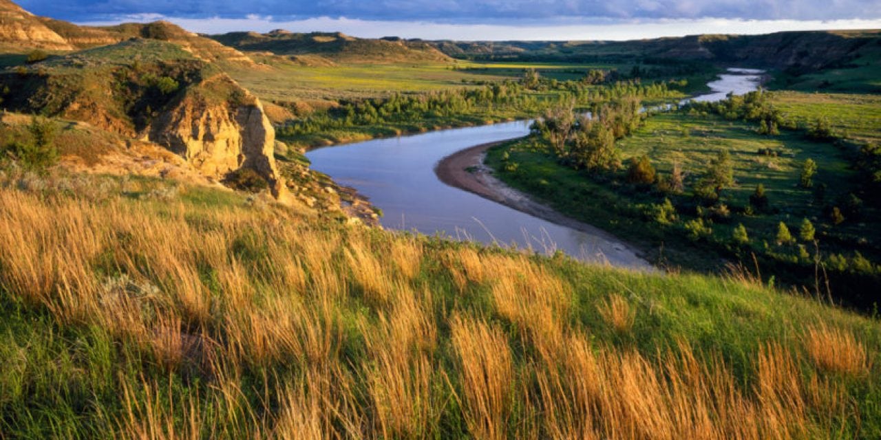
I find the south unit to be the most interesting place to photograph, mainly because of the overlooks and access to the Little Missouri River. The north unit is perhaps grander in scale, with steeper canyons and more pronounced stripes on the eroding hills.
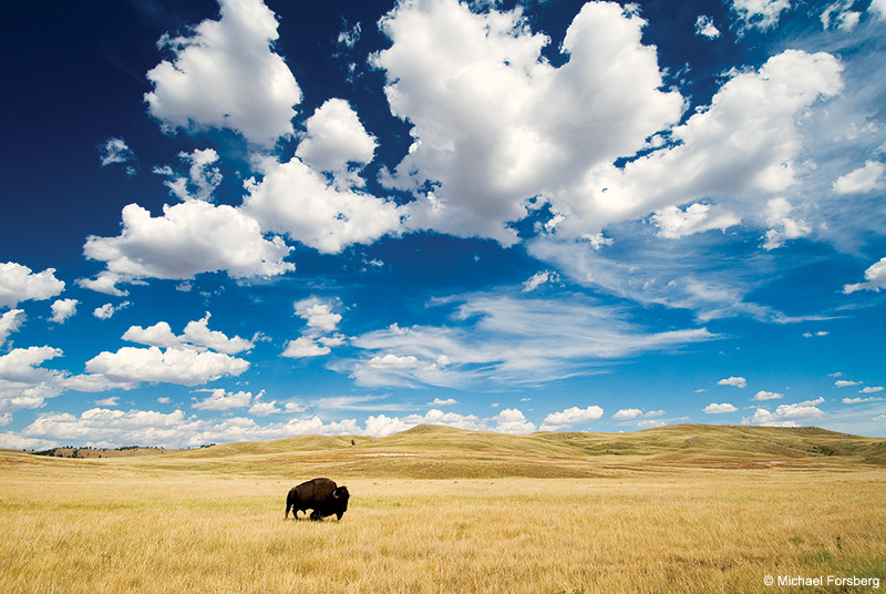
There are over 100 miles of trails in the park that lead to the river, petrified forests, overlooks, coulees and layered rock formations. There are several prairie dog towns along the scenic drive, and buffalo are a common sight. If you’re lucky, you’ll spot a band of wild horses.
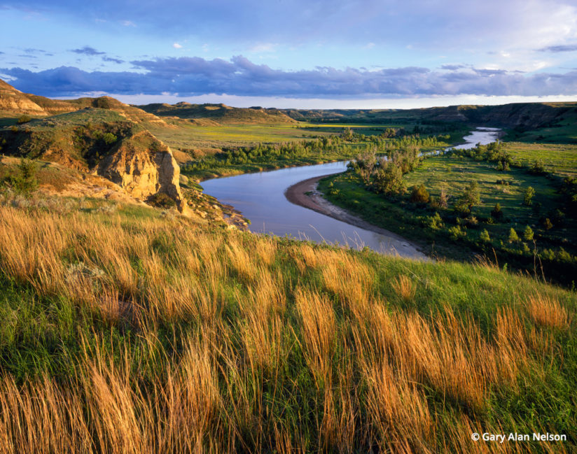
I took the photo above from the Wind Canyon Trail in the south unit. The short trail affords majestic overlooks of the Little Missouri River and the surrounding landscape. I photographed the scene with a Toyo 45AII field camera using a NIKKOR SW 90mm ƒ/8 lens and Fujichrome Velvia film. It was relatively calm and shortly after a thunderstorm had passed over. Tussocks of the previous year’s little bluestem gave diversity to the greening spring landscape.
Best Times
I prefer spring and autumn for photography in Theodore Roosevelt National Park. In these months, the prairie grasses, forbs and deciduous trees show off their seasonal plumage, and the temperatures are conducive for extensive hikes. Summer is OK, but the heat and insects can be nettlesome. Winds are considerable throughout the year, so prepare to be buffeted around a bit.
Contact: National Park Service, www.nps.gov/thro/index.htm.
See more of Gary Alan Nelson’s work at garyalannelson.com.
YOU MIGHT ALSO LIKE
Wildlife Of The Great Plains
A lingering wildness worth protecting still survives on America’s prairies. Read now.
The post Theodore Roosevelt National Park appeared first on Outdoor Photographer.