Industry leading online chart service fugawi.com, announced today that in collaboration with world-renowned OpenCPN, it has made its extensive selection of downloadable raster charts available to OpenCPN software enthusiasts worldwide. This exciting development provides the over quarter million OpenCPN (opencpn.org) users charts from fugawi.com for navigation on their Microsoft, Linux, Mac and Android devices.
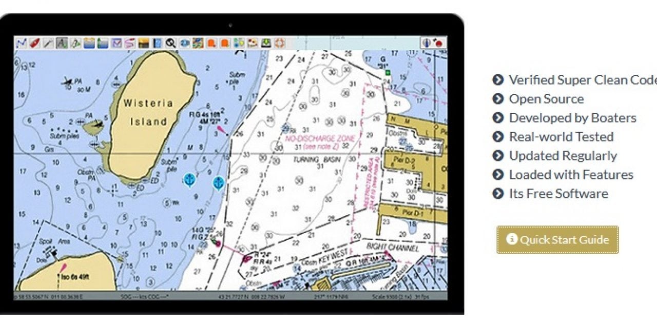
OpenCPN is a free and collaborative software, engineered by a dedicated group of experienced and highly skilled developers who strive to provide the boating public with a robust navigation tool. OpenCPN has been providing boaters with S-57 and S-63 support for the official ENCs, RNCs, and various other formats, facilitated by the integrated chart downloader. Thanks to the joint efforts with the Fugawi team, OpenCPN now adds an extensive array of quality raster charts, such as those produced by Canadian Hydrographic Service, nv charts, Delius Klasing, Solteknik and other popular chart brands.
“Our team at OpenCPN have been dedicating their time over the last decade to developing and supporting a robust software with route planning and real time navigation, AIS, anchor alarm, GRIB weather and many other features and plug-ins,” said Hubert Kleis, core member of the OpenCPN team. “With S-57 support from the outset, we recently integrated S-63 compatibility, providing access to the complete portfolio of the official ENCs for our standard and oeSENC formats. Thanks to the collaborative efforts with the Fugawi team, we can now offer our substantial recreational boating community an excellent range of quality raster charts covering many popular cruising, fishing and sailing areas around the world”.
“We are very proud of our partnership with OpenCPN,” said Robin Martel, Cartographic Manager of Fugawi. “The OpenCPN developers have created the most popular marine navigation software and our joint collaboration gives the boaters more choice with incredible coverage and detail.”
The OpenCPN built-in quilter tiles multiple raster charts into one in seconds, delivering the look and feel of a vector chart with smooth zoom and pan but with the unmatched detail and familiarity of paper charts. The fugawi.com raster charts available for OpenCPN include the official Canadian Hydrographic Service (CHS) charts of Canada; nv charts for the US, Europe, Bahamas, Cuba, Puerto Rico and Caribbean; Delius Klasing for Northern Europe and the Adriatic Sea in the Mediterranean; Solteknik Marine Charts of Sweden and Finland; Blue Latitude Press’ charts of Bahia and Sea of Cortez in Mexico; and NZ Mariner charts of New Zealand just to name a few, with more areas coming soon.
Availability
The free OpenCPN software and the dedicated plug-in for the Fugawi.com raster charts can be downloaded here for Mac, Windows and Linux operating systems. The online charts from Fugawi can be downloaded here for OpenCPN, as well as iNavX and PathAway apps. Each downloaded chart comes with two licenses that can be used on two different devices and on different compatible applications. Some charts such as those for Brazil are free. Prices for others charts are established by the providers and can vary from USD $19.99 to $199.
The post FUGAWI.COM CHARTS NOW AVAILABLE ON OPENCPN appeared first on .