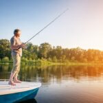
Deciding where to fish is a prime directive of every serious ice angler. Whether fishing a familiar lake or exploring new waters, it’s critical to carefully evaluate lake characteristics and features, the biological environment, local conditions and weather to appropriately temper your strategies.
A quick review of a comprehensive hydrographic map will reveal depth contours and key structures, along with a number of additional relevant details, including the location of inlets and outlets, predominant bottom content distribution, types of available cover, water clarity, types of fish and forage present and how prominent each is within the fishery.
Plus, given the wealth of related information now available through websites, social media, electronic mapping apps, blogs and the associated speed this type of information travels, evaluating and identifying productive locations is easier than ever.
I believe most of today’s knowledgeable ice anglers selectively sift through these sources, using them to discriminately determine the structures most likely to produce–yet many overlook critical, more subtle fish holding features that may substantially increase their odds of success.
I call these high-percentage spots “contact points,” and here are a few such examples.
DEPTH CHANGES
Depth changes comprise rather obvious breaks, and better yet, prominent contact points. Yet it’s important to understand not all depth changes are created equal. The productivity of a drop off lining a commonly sought structural element–say a shoreline point—will vary based on the type of lake you’re fishing, its depth, species you’re seeking, available cover, forage present, how far the season has progressed and current conditions.
For the sake of a generalized example, let’s evaluate this classic structure and review how to differentiate a good shoreline point from an exceptional one, starting by evaluating the slope of the surrounding depth change.
SLOPE
I’ve discovered “stair-stepped” sloping breaks from a shoreline point leading to a relatively deep basin are usually more productive than gradually or steeply sloped ones, simply because this variegated formation provides more options for fish. They can slide up toward the shallows and scatter throughout the adjoining flat to access forage as conditions allow, or just as easily slip back down using this favorably sloped point as a migration route, following the slope into deeper water and staging at various positions along the way, as conditions dictate.
Don’t get me wrong: Points with more uniform or abrupt slopes will draw fish—a steep wall may constitute a distinct location game fish may use to “herd” a school of baitfish, and a gentle, more gradual slope with plentiful cover and forage will certainly attract fish at times. But you must prioritize each structure based on the situation, and stair-stepped breaks typically offer the greatest potential under a much wider range of conditions.
STRUCTURAL DIVERSITY
Next, let’s look at structural diversity.
If the stair-stepped point you’ve identified features a hook-shaped tip, rather than just jutting straight out, that’s a definite plus. Secondary protruding fingers and cutbacks, or a combination of what I call “secondary” or “microstructure”—essentially edges featuring smaller fingers, cuts, and their associated turns rather than just a homogenous, ‘straight-line’ break–are beneficial, too, as each represents a potential fish magnet.
Often such slight nuances won’t appear on most maps, so you’ll have to work to find them, but the rewards are well worth the effort.
SADDLE AREAS BETWEEN VARYING FORMS OF STRUCTURE
Our point also escalates in value if it’s found in close association with other forms of structure. Should there be a sunken island separated from the point but not far away, this combination not only provides more contact points to draw fish, but is much more likely to support a variety of forage that not only attract, but will hold fish there.
Such locations may also offer another key fish holding feature: Saddles.
Often in situations where two or more structural elements are found in close proximity, you’ll find what’s called a “saddle” area separating them. This is simply a coined term for a region located between prominent structures where fish congregate to rest or feed, with the easy option of shifting from one structure or the other, as desired.
Should such an area exist where you’re planning to fish, it’s certainly worth checking, especially during “off-times” such as during the advent of a cold front, bright, mid-day conditions, periods of heavy fishing pressure or activity on the associated structures themselves—essentially any such variable or combination thereof that might push fish utilizing these structures into slightly deeper water.
BOTTOM CONTENT CHANGES
Another way to assess the value of our sample point is to note if any bottom content changes exist. If the point being fished is a hard bottom one comprised of rock or sand stretching out into a soft bottom saddle, this bottom composition transition creates an attractive break and will often result in a subsequent change in the type of cover and forage available, too–comprising a distinct contact point fish very worth looking into.
You might find one type of vegetation growing on the sand/rock mix and another in the mud, for example, with bait fish utilizing the hard bottom cover and bloodworms burrowed in the softer sediment. This biological diversity is something that ultimately offers strong potential for drawing not only a greater variety, but number of fish as well.
VARIATION IN TYPE OF COVER
At times, variations in cover type might be much more distinct: Locations where a weed line meets a rock pile, for instance. Of course, these variations may be completely unrelated to a bottom content transition: A simple change from vegetation to wood might create a premium fish holding attraction.
Like bottom content variations, edges where assorted cover types meet often attract an increasingly diverse forage base, increasing odds the area will draw game fish, too.
VARIATION IN DENSITY OF COVER
Secondary breaks may also be considerably more subtle, yet no less important.
As an example, I’ve found variations in the density of cover can be a huge draw. During bright conditions, fish may shift deeper or into increasingly dense pockets of vegetation, then slide back out along edges during low-light or overcast conditions. Locations along weed edges offering such diversity are thus more likely to hold greater numbers of fish in a wider variety of conditions than those without.
Similarly, breaks featuring larger downed trees with a complex array of branches, or taller stumps with exposed root systems amid smaller, less diverse ones would both offer comparably potential benefits.
VARIATION IN HEIGHT OF COVER
Another subtle variation is the height of the cover present.
These aberrations are usually associated with changes in depth, but not necessarily. Anytime you can find substantial clumps of vegetation growing higher than the surrounding canopy, or simply pockets formed by plants of lower stature, fish may use them based on the conditions you’re facing. Be sure to check them out.
SUMMARY
So next time you’re reviewing a lake map and searching for locations to fish, evaluate each feature carefully before making a decision, always looking for diverse sites offering the healthiest combinations of “microstructure”–spots I fondly call contact points. You’ll find attention to such details will have a definite impact on your overall success!
The post Contact Points appeared first on .