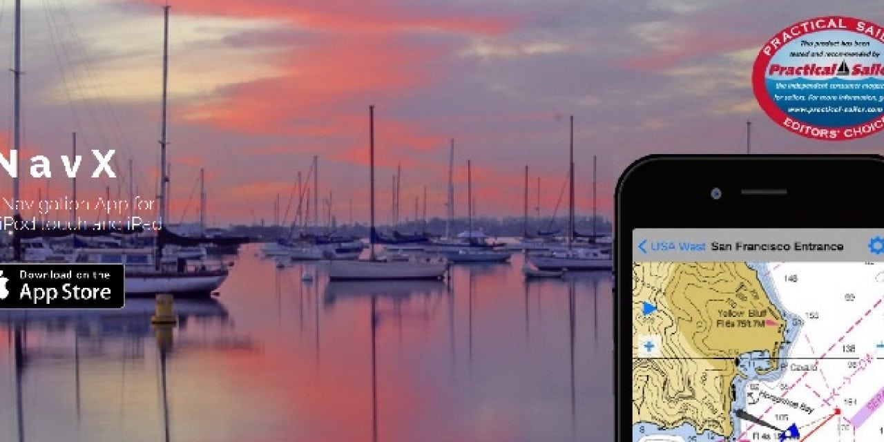
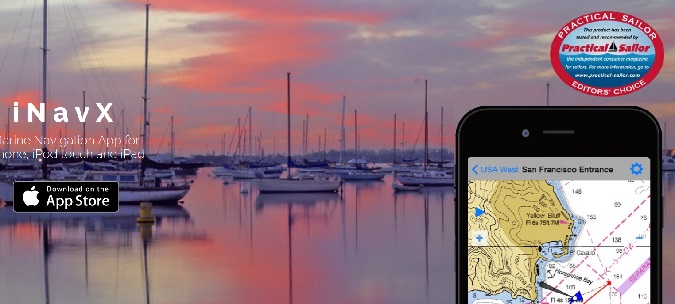
iNavX, the benchmark marine navigation mobile application, announced today, in partnership with Fugawi and Navionics, the availability of Navionics charts in the iNavX In-App Chart Store. This is a first for the industry, and iNavX is the only independent marine navigation app to offer Navionics charts to its users.
“When it comes to crucial navigation information, boaters’ decisions about what apps, electronics and charts they use can be as varied and personal as the foul weather gear they wear to keep them dry,” said Shaun Steingold, CEO, NavX Studios. “The most respected name in electronic charting and cartography is Navionics and we are proud to be the only independent marine navigation app to offer our users one touch in-app purchase and download of the award-winning Navionics marine charts and maps. iNavX gives boaters tons of features, but we also give them a choice – the most powerful capability of any handheld navigation system.”
“We accept no compromises in both the products we produce and the business partnerships we enter into,” said Don Black, senior vice president of global sales and marketing at Navionics. “iNavX has demonstrated that they share our high standards and offer users a powerful and feature-rich platform. Boaters will appreciate that our charts can now easily be downloaded and used in iNavX’s robust handheld navigation system.”
iNavX is the only marine navigation app that delivers hundreds of charts and features to sailors, boaters and anglers. The perfect marine navigation chartplotter that also fits in the palm of your hand, iNavX can be used as a chartplotter, a toolkit or as a redundancy system. The feature-rich app is capable of displaying current position in real-time using a mobile device’s built-in GPS, as well as plotting course, bearing and waypoints. Supporting NMEA data over TCP/IP, iNavX also integrates with external GPS, AIS receivers and transponders, and networked instruments including depth, speed, wind, engine data, and battery voltage meters. Users can easily manipulate data by panning, zooming and rotating charts, as well as downloading GRIB weather forecasts.
“We have been deeply involved in the integration of these best-in-class products,” said Robin Martel, president, Fugawi. “By bringing together the most popular electronic cartography and the most feature-rich navigation platform, users of iNavX will never need to look for another solution again.”
Availability
iNavX is available for Apple iPhone, iPod Touch and iPads from the App Store, and is priced at $24.99. Current in-app offerings include Navionics Nautical Chart in broad coverage areas worldwide. Future updates will shortly be released to include Navionics SonarChart 1 ft/0.5 m HD bathymetry maps and Community Edits, both enriched by boater input. Prices vary by region. For more information on iNavX contact press@inavx.com or visit www.inavx.com.
The post INAVX ANNOUNCES AVAILABILITY OF NAVIONICS CHARTS IN INAVX IN-APP CHART STORE appeared first on ODU Magazine-North America's #1 Digital Fishing Magazine.