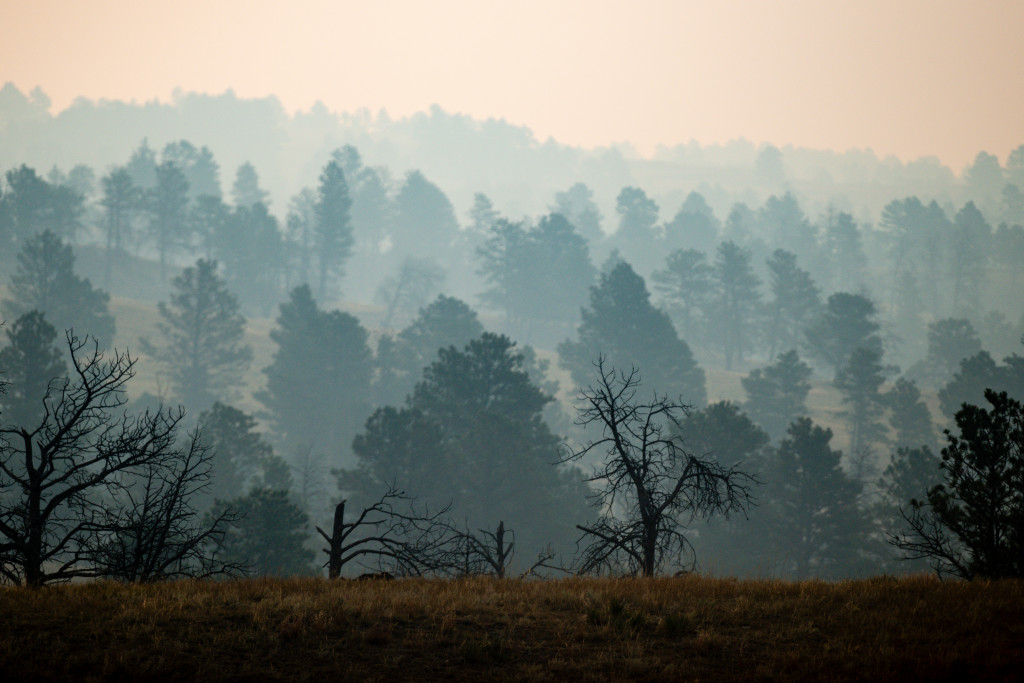
Catastrophic wildfires have ravaged more than half of northwestern Nebraska’s pine forests. Land managers are making strides toward a more sustainable future.
Enlarge
Story and photos by Justin Haag
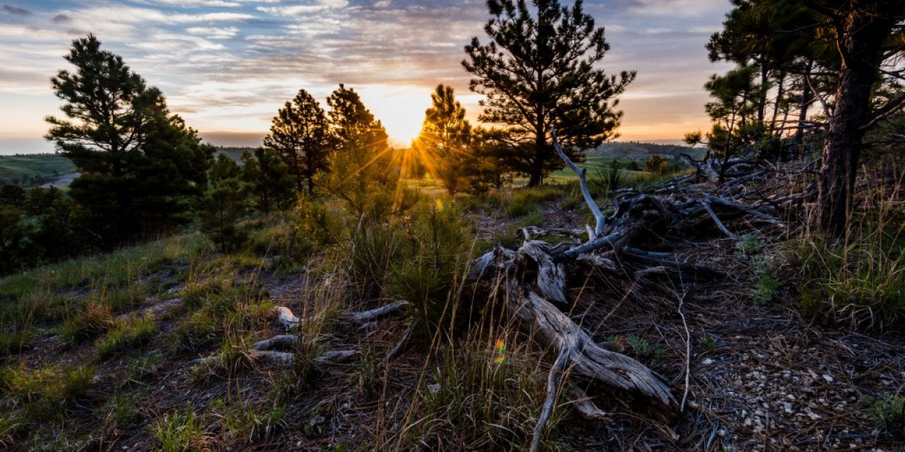
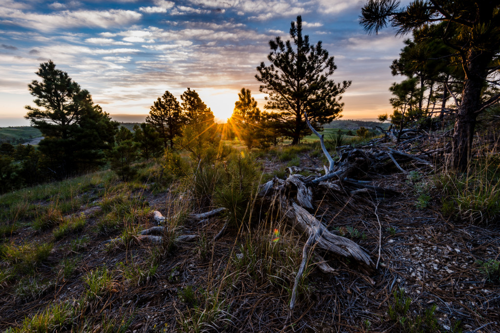
On this sunny day, Bryce Gerlach is visiting a timber-thinning project at Gilbert-Baker Wildlife Management Area in the northwest corner of the state. Gerlach, who is a forester funded by the National Wild Turkey Federation and the Nebraska Game and Parks Commission, likes what he sees.
“This is the project that is going to save Gilbert-Baker someday,” he says as he looks over this part of the Pine Ridge that, unlike other areas of the region, does not bear the
scars of wildfire. Gilbert-Baker, north of Harrison, is recognized as a jewel among the eight scenic wildlife management
areas that comprise more than 19,600 acres in the Pine
Ridge.
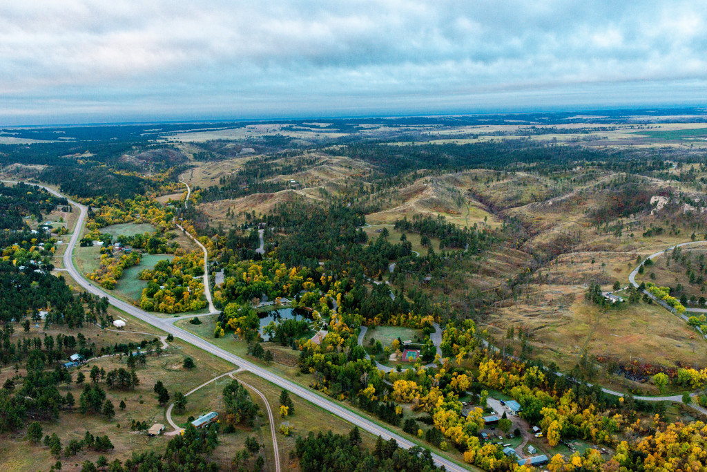
Gerlach is surveying the northwest portion of the property, where sandstone ridges and buttes rise some 1,000 feet from the Hat Creek Basin and provide a sweeping view of the grasslands to the north. Mixed among the magnificent landforms and rugged terrain to the south is the towering forest of ponderosa pine – the iconic tree of the West for which the Pine Ridge region is named.
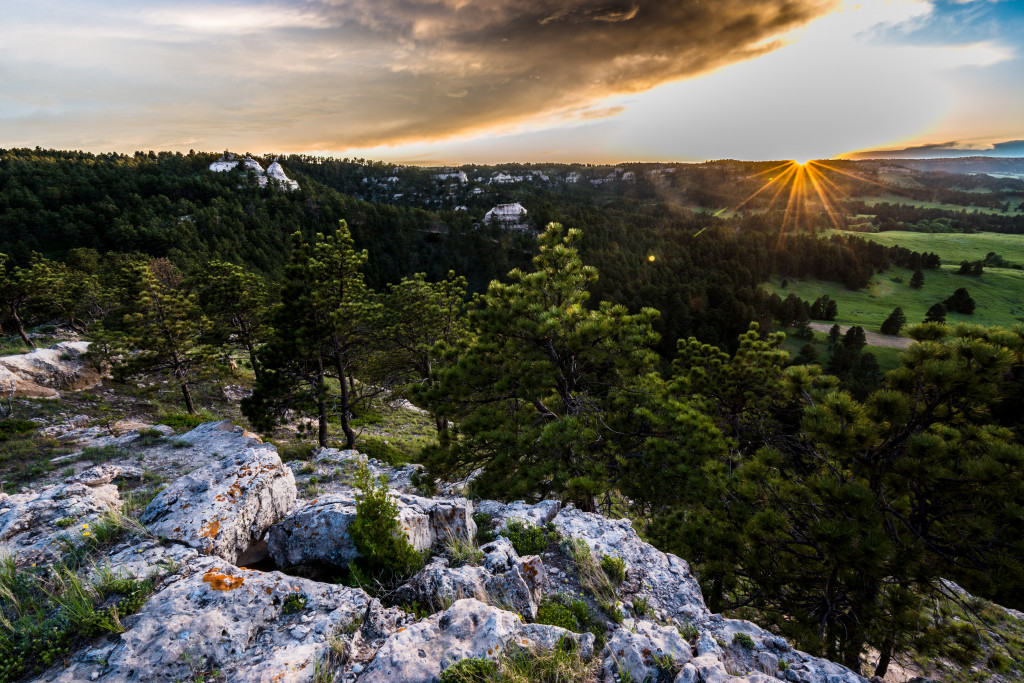
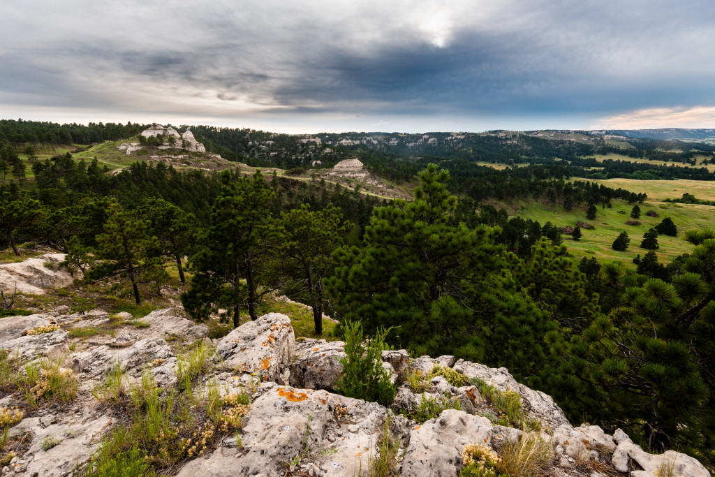
Gilbert-Baker is reminiscent of what once existed throughout almost all of the Pine Ridge, a roughly 10-mile wide escarpment that spans about 100 miles across northwestern Nebraska between the Wyoming and South Dakota borders. Only 2 percent of the Cornhusker State is forested, so the pines and rugged topography here are especially valued and have long served as a destination for outdoor enthusiasts.
The Challenge
The management decisions of Euro-Americans and their descendants were not ultimately beneficial to
the landscape of the Pine Ridge. Prior to the settlers’ arrival in the 1800s, lightning strikes caused periodic wildfires that burned in the understory of forest and boosted plant diversity. In addition to natural causes, American Indians used fire to burn the brown plant matter on the landscape to start afresh with green plants – an attractant that served well for hunting some of the 30 million bison that once roamed North America.
With motivations that included preserving lives and property, the first generations of Euro-Americans on the Plains extinguished wildfires at every chance, and hunted bison to near extinction. Consequently, pine stands, especially where logging was not feasible, grew thick. The result is what land managers call “dangerous levels of fuel accumulation.”
As periods of drought gain intensity with global warming, land managers know the potential for disaster looms heavy. The danger was especially evident, and realized, in 2006 and 2012 when more than 100,000 acres burned in catastrophic wildfires that raged across the landscape and charred trees from bottom to top. The wildfires’ toll was heavy as about 120,000 acres remain of the estimated 250,000 forested acres in the Pine Ridge prior to the 1950s.
Simulating Nature
Where possible, land managers thin the forest in a way to mimic nature. The result is decreased fuel loads and returning forest structure to historic conditions. The ultimate goal is sustainability.
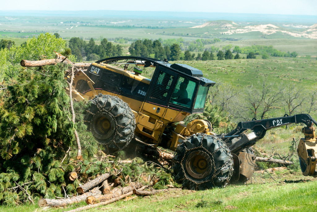
In places such as Gilbert-Baker, however, the steep terrain that gives the land aesthetic appeal eliminates most practical means of thinning the forest. Moreover, while some pines have been harvested in the region, the market has not been strong enough to maintain high demand of timber there.
Thinning is a concept easily related during times of “social distancing.” If a fire reaches the top of one pine, it will spread to the crown of another nearby and continue raging as long as it can. Thinning keeps fires at an intensity low enough that trees distanced appropriately can survive such events, and the forest may even be better for them.
The project at Gilbert- Baker, where an old service road has been cleared of pines at a width of about 100 yards, is a prime example of methods being used throughout the Pine Ridge to make immediate impact.
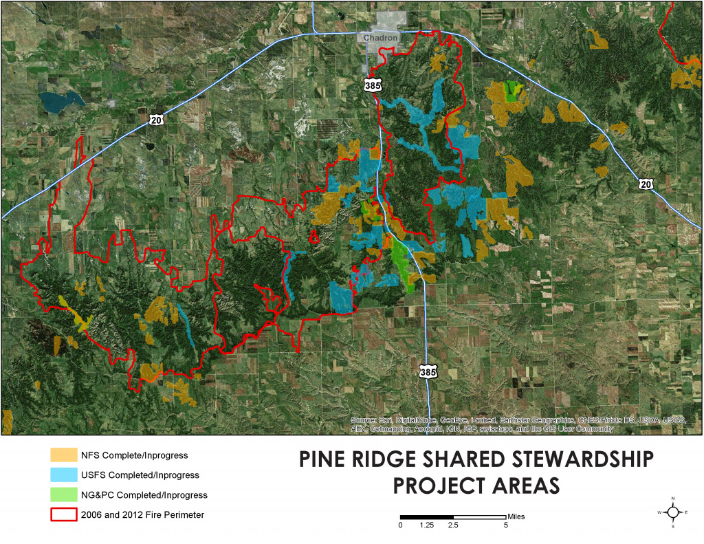
Fred McCartney of the Nebraska Forest Service facilitates cost-share programs with private landowners and public land managers to best leverage available money. Much inspiration for his work, he said, comes from a first thing firefighters want to know when responding to a blaze: “Where are the sides of the box?”
That is, where is an accessible break in the trees where the fire can be stopped? Knowing such locations can help contain wildfire to established areas and prevent unrestrained spread throughout the Pine Ridge. With a system of firebreaks, the hope is to at least limit the size of wildfires.
“We’re building those box sides and communicating them to area fire departments,” McCartney said, as he points to a map of the Pine Ridge with areas shaded in various colors to show projects in progress and completed. “Absence of a commodity to pay for the work, this is the best approach; the best bang for our buck.”
A primary focus area of the collaborative effort has been the U.S. Highway 385 corridor, which runs north and south through the ridge near Chadron and features many private tracts interspersed among public land. Through cooperation between the Nebraska Forest Service, Game and Parks, the U.S. Forest Service and the many landowners, a large buffer has been created through thinning. In the event of another large wildfire, the area will be invaluable in efforts to stop it from moving east or west.
An area of emphasis in the collaboration has been Chadron State Park. Situated along the highway, it had experienced valuable thinning prior to 2012 and, though that year’s fire burned through much of the park, it did not charge eastward. Since then, the park has undergone more thinning and the removal of burned trees.
The Strategy of Thinning
For thinning, land managers are strategic in selecting trees to cut. Gerlach prefers an approach he calls “groupy-clumpy.” With that method, trees are not spaced uniformly throughout large areas, but rather in small groups. This approach keeps crown fires from spreading, yet lessens the likelihood that the trees will be uprooted or damaged by the wind. The groups of trees also serve as a seed source.
Gerlach said about 2,200 acres have been treated on state wildlife management areas in the Pine Ridge with thinning and removal of “ladder fuels,” the brush and other vegetation that helps fires climb trees.
The other big public land organization in the Pine Ridge, the U.S. Forest Service, has completed about 4,000 acres of thinning and logging on lands primarily between East Ash Creek Road and Bordeaux Road.
Silver Linings
Rick Arnold, a Game and Parks wildlife biologist who oversees the Pine Ridge WMAs, notes a silver lining in the cloud of 2012.
“Most of the WMAs that were burned in 2012 have tree regeneration that I do not see from other large fires like in 2006 and 1989,” Arnold said. “You can walk through the ’12 footprint and find 1- to 2-foot pines coming in.”
Also on the bright side, the wildfires of 2006 and 2012 garnered a lot of attention and prompted needed funding for some of the region’s forestry demands.
The pines are tall, the terrain is rough, and the equipment is large, so thinnings are not cheap. Various factors play into it, but thinning projects generally range from $300 to $950 per acre.
“With the land being appraised at very close to the high end of those project costs, it is hard to do a landscape-level job without several partners and adjacent landowners doing projects as well,” Arnold said.
Money from the Nebraska Environmental Trust has been critical. Support from the trust, which operates with proceeds from the state lottery, dates back more than two decades, and it has contributed well over
$1 million to Pine Ridge forest management since 2006.
The trust grants often require a sizable match, and that is where many partners come into play. For Game and Parks forestry projects, for instance, there is considerable collaboration and multiple financial supporters.
Another big funding source, especially for private lands, is the U.S. Forest Service’s State and Private Forestry program. Money collected from the Pittman-Robertson Act’s excise tax on sporting goods and State Wildlife Grants, administered through the U.S. Fish and Wildlife Service, also have been instrumental.
Cows and Flames
Thinning projects are a benefit to the forest from a fire perspective and also a wildlife one. For instance, a multi-year thinning of more than 200 acres underway near the buttes at Fort Robinson State Park is designed to not only provide fire protection for the park and nearby community of Crawford, but also to boost wildlife habitat for species ranging from bighorn sheep to bats. Just as the vegetation gains diversity with open areas among tall trees, so too does wildlife.
Managing the density of pines is just one of many aspects of management in the Pine Ridge, and the changes come with consequential challenges. Arnold notes that the ecology of the forest floor changes with removal of shade.
“We are, in theory, just reorganizing the fuels. We went from a heavy fuel model, the dense forest, to a more open savannah with grass understory,” he said. “Now, we need to manage the fine fuels, the grass.”
A point of emphasis has been to create infrastructure for grazing. He said most of the wildlife areas in the Pine Ridge do not have adequate livestock infrastructure, such as fences and water sources. Thanks to partnerships, that infrastructure is being constructed so grazing can be used to meet management objectives while not damaging habitat.
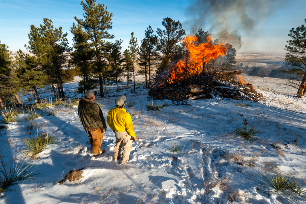
Along with thinning, Arnold sees grazing to be instrumental to balancing the needs of the forest, even if it is done with cattle instead of bison. Also important, he said, is reintroducing fire to the land.
“With the right prescription we can put ‘safe’ fire on the landscape and restore a historic fire regime,” Arnold said. “Fire is needed to naturally thin and prune ponderosa pines.”
Even though staff is highly trained and prescribed fires follow strict guidelines, it is not always an easy sell.
“The challenge is mainly a social one,” he said. “The public sees the catastrophic wildfires and perceives all fire to be a bad thing and it has been suppressed so many years. Our goal is to do a forest management timber thinning and then use fire to maintain these areas so they do not go back to overgrown stands.”
Fire also can treat areas already struck by catastrophe. Game and Parks has plans with the U.S. Forest Service and an adjacent landowner to conduct the largest prescribed burn ever in the Pine Ridge this fall; it’s an area encompassing about 1,500 acres from Chadron Creek Ranch Wildlife Management Area near U.S. Highway 385 to Deadhorse Road 4 miles to the west. That burn, which will capitalize on dry conditions of the season, has a goal of removing the fallen “jackstrawed” timber that was scorched in 2012. That deadfall is complicating noxious weed control and hindering access.
Bringing the Forest Back
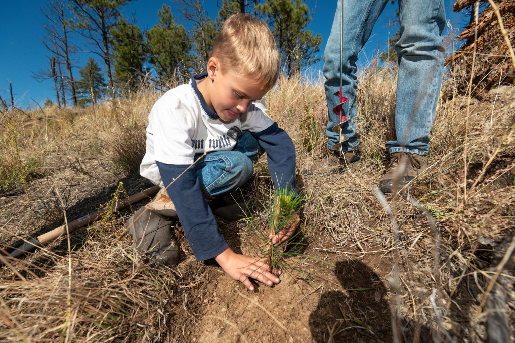
Those who have long loved the Pine Ridge have resigned themselves to the prediction they will never see it as rich with big pines as it was. Although pine growth in burned areas is occurring, ponderosas are slow-growing trees and success is sporadic.
An effort to replant 10,000 pines on the hills south of Chadron State College after wildfire threatened the campus and community in 2006 yielded virtually no surviving trees, for instance. On the other hand, annual plantings of deciduous trees and pines on Bighorn WMA, the Commission’s property that burned most intensely in 2012, have done well the past few years. The U.S. Forest Service has planted about 2,200 acres of ponderosa pines and 50 acres of hardwoods in riparian areas at points throughout the region. The Boy Scouts of America planted pines at Fort Robinson State Park for 25 years following the park’s 1989 catastrophic wildfire, and have conducted similar operations at Chadron State Park for the past five years with some success.
Nevertheless, planting pines is largely avoided because it is labor-intensive, unpredictable and costly. A much better approach, officials say, is protecting pines still standing. “If we want to ensure that there’s a forested Pine Ridge in the future, we need to protect these seed sources,” McCartney said.
Regardless, the goal is not to get back to the way things were, said Tim Buskirk, U.S. Forest Service district ranger.
“I would say we are on the way up when it comes to recovery, but it’s a relative term,” Buskirk said. “Our goal isn’t to fix everything that has changed. Our goal is to improve the resiliency of the Pine Ridge: Do things that will lessen the effects of the next fire that comes through the area and begin to incorporate more prescribed fire along the way.”
No doubt, land managers have plenty of other jobs to keep themselves busy in the areas that burned.
“Over the next few years, the cleanup will continue. Building fence and piling trees that continue to fall over,” Arnold said. “I have been told by others that have seen the catastrophic fires that it takes 10 years to recover from infrastructure damages, and I think we are on pace with that from 2012. I do think in five or 10 years we will see much more regeneration from the 2012 footprint than we have seen in the 2006 burn area. There were enough trees that put on seed before they passed, and we have had several good years of precipitation to provide for good regeneration.”
Those years of above-average precipitation have helped buy time to complete forest management projects, but everyone expects a drought cycle to return soon. When it does, the Pine Ridge will be more prepared.
Air Support
While the practices of land managers are helping prevent catastrophic wildfires, the capability to respond to fires also has improved. With such rugged landscape, it helps to attack fire from above.
After the wildfires of 2006 and 2012, officials recognized the need for first-responders to have more resources for wildfires. One result was increased aerial capabilities from the Legislature’s Wildfire Control Act of 2013.
In conjunction with the Nebraska Forest Service, the Nebraska Emergency Management Agency contracts a single-engine air tanker, known as a SEAT plane, to be stationed in western Nebraska during fire season. With designs based on agricultural sprayers, the small aircrafts can get to places trucks cannot and possess the capability to make substantial impact by dropping 800 gallons of water or retardant in a single action. With bases in Chadron, Valentine, Alliance, Scottsbluff and McCook, the airplane is serving where Nebraska’s range fire danger is greatest.
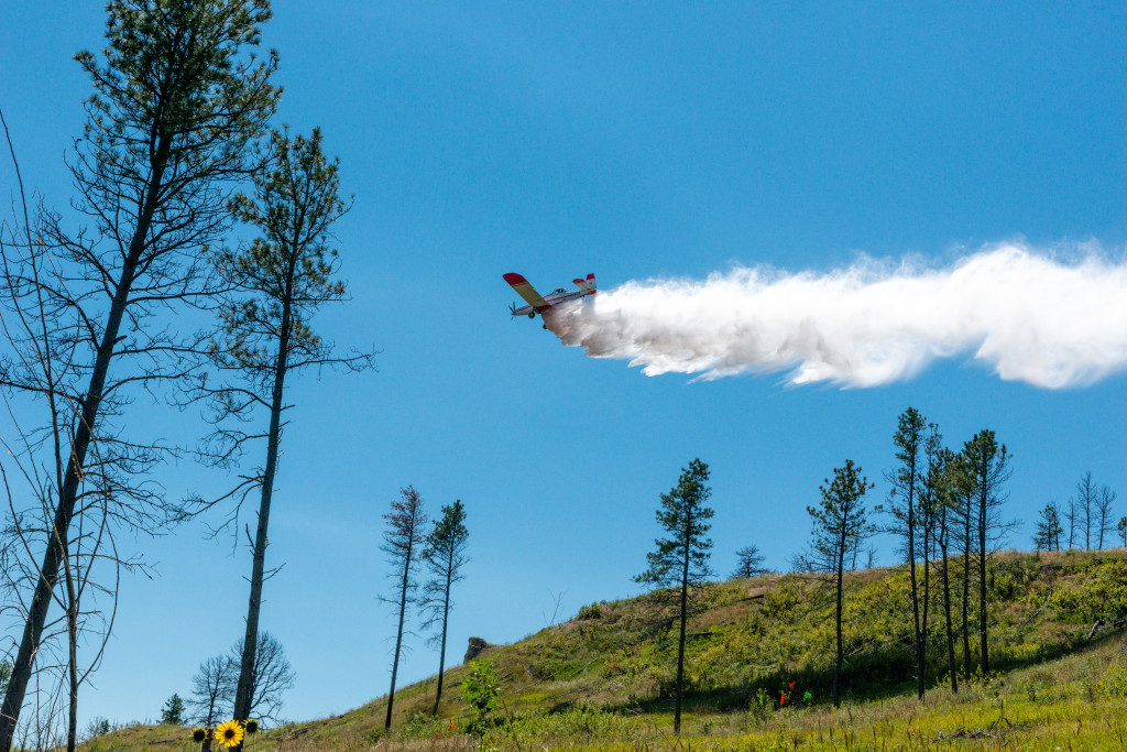
Seth Peterson, a Nebraska Forest Service employee who serves as the SEAT base manager in Chadron, said the goal is to have the airplane loaded with retardant, off the ground and communicating with the fire chief within 15 minutes of receiving a dispatch.
“Our goal is to provide a quick response to volunteer fire departments on small fires, hopefully keeping them small before they cause any real problems,” Peterson said.
It seems to be working. He said there has been just one fire over 500 acres in the Pine Ridge since the program’s inception in 2013. If a fire is highly active and growing, Nebraska may call upon its relationship with South Dakota Wildland Fire. That organization usually has an additional SEAT at nearby Hot Springs to serve the Black Hills.
“Then, we may have two SEATs reloading at the Chadron SEAT Base, providing quick and continual aerial suppression to any Pine Ridge fire,” he said. “In return, we have allowed South Dakota to utilize our SEAT many times.”
Burning Questions, Uncertain Future
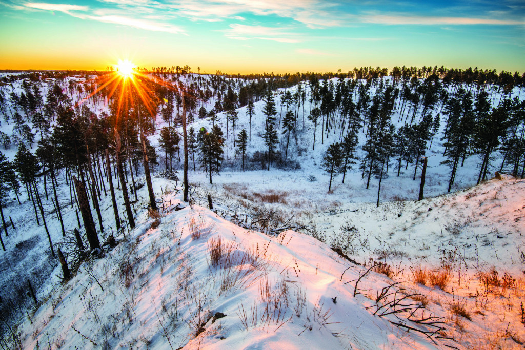
No one knows for certain what the future brings to the Pine Ridge wildfire scene, but officials are making strides in preventing past horrors. Healing from catastrophic wildfires takes time, for both human emotions and the landscape.
Regardless, unrivaled beauty remains in the region, both in places that have not been scorched and those that have. While the landscape has been altered, a new kind of splendor is in these burned areas. The fires uncovered many landforms previously obscured under the blanket of trees, and in many places improved the ecology.
The Pine Ridge surely will always be an attraction. Thanks to the coordinated efforts of many, there is a much better chance a sustainable pine forest will be there forever, too. ■
The post Preserving the Pine Ridge appeared first on Nebraskaland Magazine.